Trail data in this guide is sourced from AllTrails community reviews (5,112+ reviews for East Indio Hills Badlands alone), Trailforks verified trail data, CVMSHCP (Coachella Valley Conservation Commission) official trail management pages, and Visit Greater Palm Springs editorial hiking resources. Distances, elevation gains, difficulty ratings, and trailhead logistics are confirmed from multiple independent sources as of May 2026.
Last Updated: May, 2026
Forget the generic “Indio is a great destination” preamble. If you are tracking down the best Indio Hiking Trails, you are looking for raw terrain, not festival turf. I know this valley inside out, and the geographic reality is spectacular.
Indio sits right in the belly of the Coachella Valley, sandwiched between the crumpled Indio Hills badlands to the north and the jagged Santa Rosa foothills to the south.
Within 20 minutes of downtown, you can be standing directly on the San Andreas Fault line, squeezing through slot canyons, or looking out over the Salton Sea all the way to San Gorgonio Mountain.
Do not test the summer. When daytime temps surge past 100°F, these exposed routes turn into actual ovens with zero shade.
Every local forum and trail guide screams the same rule because it saves lives: pack double the water you think you need, and slam electrolytes before you step out.
After baking in the valley dust, you will want a massive pool to drop into. I will break down the Stay Wandery group properties later in this guide, which are literally custom-engineered for heavy group recovery with private pools and slides.
Let’s get into the trails. Starting with the one everyone asks about first.
The Top 10 Hiking Trails Near Indio, CA
I love exploring the Coachella Valley, but you have to know what you are getting into before hitting the dirt here. Local hikers know the desert is unforgiving, especially when the temperatures regularly exceed 100°F and can reach 118°F in peak summer.
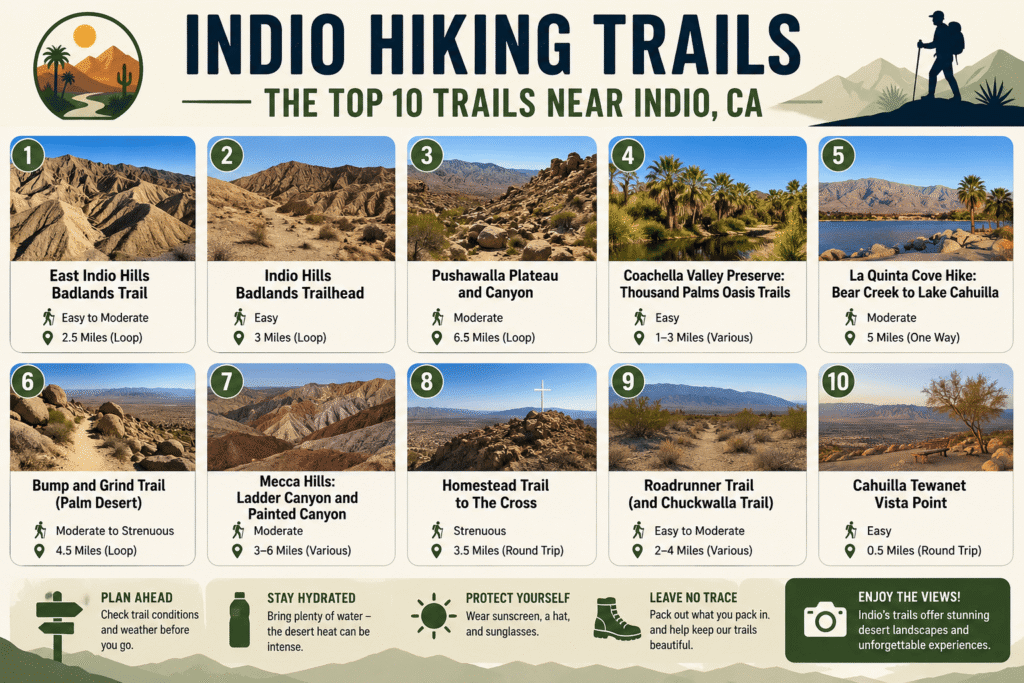
If you want to bypass the generic advice and find the exact trail constraints, look closely at this breakdown of the top ten routes around Indio.
1. East Indio Hills Badlands Trail: The #1 Indio Hiking Trail
Location: Trailhead at 42000 Golf Center Pkwy, Indio, CA 92203
Distance / Elevation: 5-mile loop; 767 ft elevation gain.
Difficulty: Moderate.
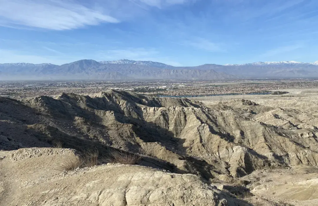
What Makes It Worth Your Time: You are walking directly across the active San Andreas Fault through a maze of mudstone and sandstone slot canyons at East Indio Hills Badlands Trail.
Just prepare yourself for the massive sandy wash slog at the start, download an offline map since the canyon splits get confusing, and pack at least two liters of water to tackle the exposed ridges safely.
2. East Indio Hills Badlands — the shorter 3.4-mile version
Location: 42000 Golf Center Pkwy, Indio, CA 92203 (same trailhead as #1)
Distance / Elevation: 3.4 miles; 585 ft elevation gain.
Difficulty: Easy.
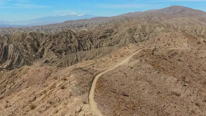
Why it is worth your time: this is the shorter, easier version of the East Indio Hills Badlands loop, launched from the very same parking lot. The shorter Indio Hills Badlands route is the quieter, more family-friendly way to experience the same fault-line geology without the full five-mile commitment.
The CVMSHCP keeps the path well-maintained, and you can complete it in well under two hours.
Keep your eyes on the ground here because you can actually spot tiny ancient seashell remnants left behind by Lake Cahuilla millions of years ago.
The Coachella Valley Conservation Commission keeps this path well-maintained, and it is a stellar choice if you want to get in and out of the canyons in under ninety minutes.
3. Pushawalla Plateau and Canyon
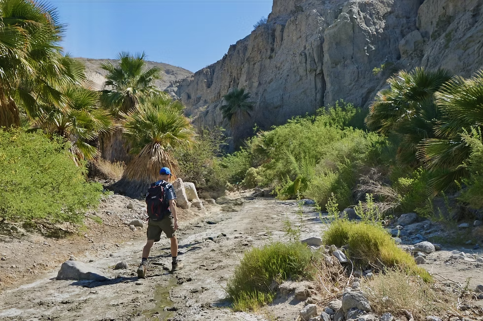
Location: Thousand Palms Canyon Rd, Desert Hot Springs, CA 92241
Distance / Elevation: 7.1 miles; 1,597 ft elevation gain.
Difficulty: Strenuous.
What Makes It Worth Your Time: Pushawalla Plateau and Canyon is the most grueling, high-elevation track in the Indio area, making it a pure fitness test meant for experienced desert hikers.
The initial push follows the historic Coachella Canal from 1949, but the real payoff comes when you top out on the massive plateau for a panoramic valley view.
There is zero shade protection out here, so do not even think about stepping onto this ridge without carrying a minimum of three liters of water and plenty of electrolyte tablets.
4. Coachella Valley Preserve: Thousand Palms Oasis Trails
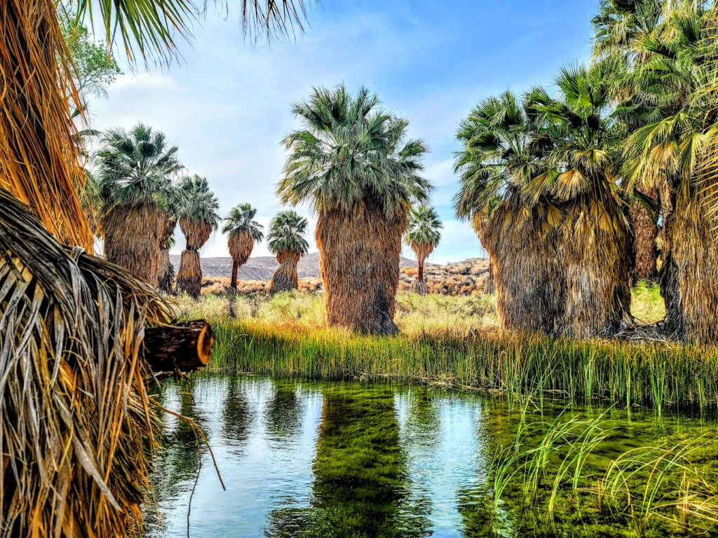
Location: 29200 Thousand Palms Canyon Rd, Thousand Palms, CA 92276
Distance / Elevation: Multiple options from 1 to 4.5 miles; Pushwalla Palms Loop is 4.5 miles.
Difficulty: Easy to Moderate.
What Makes It Worth Your Time: Walking onto these wooden boardwalks feels like dropping into a completely different world because a massive natural fan palm oasis feeds directly off the San Andreas Fault groundwater.
Coachella Valley Preserve is an incredibly lush change of pace from the surrounding dry siltstone, giving you options for quick walks or longer loops around Willis Palms.
The visitor parking lot fills up incredibly fast during the peak winter season, so you will want to claim your spot early in the morning.
5. La Quinta Cove Hike: Bear Creek to Lake Cahuilla
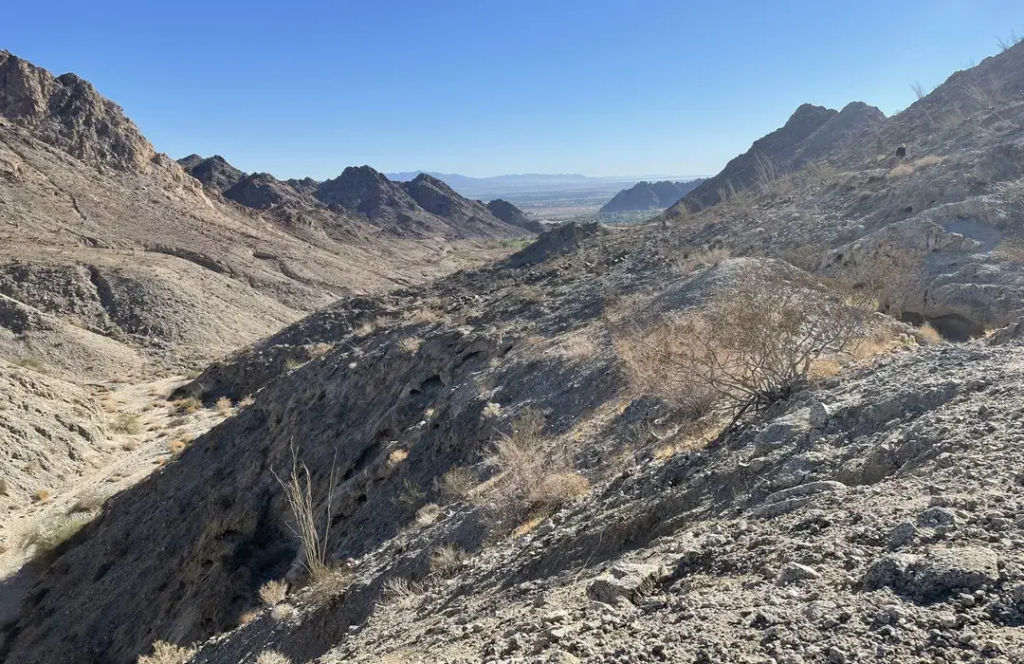
Location: La Quinta, CA 92253
Distance / Elevation: Variable routes; La Quinta Cove to Lake Cahuilla adds 2 to 5 miles.
Difficulty: Easy to Moderate.
What Makes It Worth Your Time: Tucked right into the top of the cove, this beginner-friendly trail network is an absolute favorite for local families looking for a quick mountain fix.
You can start your morning at the Fred Wolff Bear Creek Nature Preserve, where the trails are wide and highly accessible.
La Quinta Cove Hike is one of the absolute best spots in the area to walk your dog on a leash, plus you are only a few minutes away from Old Town La Quinta for iced coffee afterwards.
6. Bump and Grind Trail (Palm Desert)
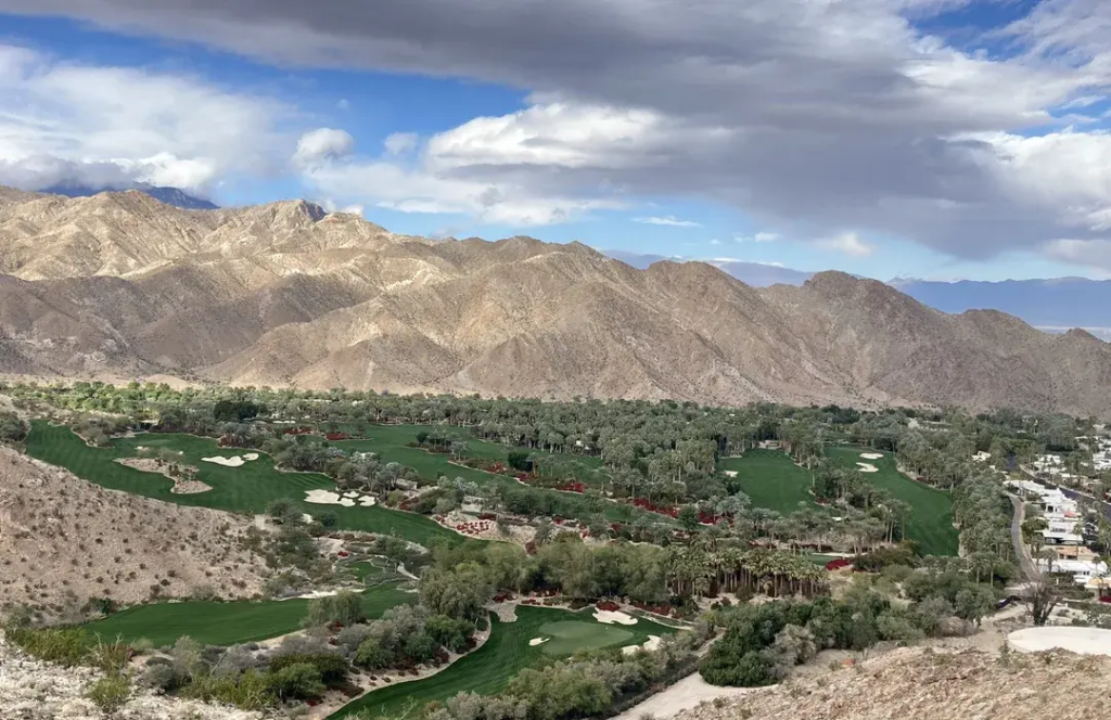
Location: Painters Path, Palm Desert, CA 92260, United States
Distance / Elevation: 4-mile loop; approximately 1,000 ft elevation gain.
Difficulty: Moderate.
What Makes It Worth Your Time: Bump and Grind Trail is the ultimate neighborhood workout loop that snakes up the ridges of the Santa Rosa Mountains to give you sweeping views of the valley sprawl.
The trail is heavily trafficked year-round by locals, so remember to be respectful of the residential street parking near the El Paseo retail corridor.
7. Mecca Hills: Ladder Canyon and Painted Canyon
Location: Painted Canyon Rd, Mecca, CA 92254
Distance / Elevation: 3 to 6 miles, depending on the route; Mecca Hills East Loop is 5.2 miles.
Difficulty: Moderate to Strenuous.
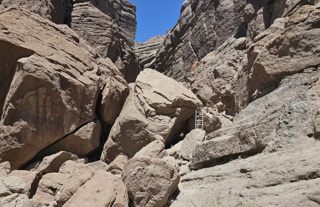
What Makes It Worth Your Time: If you want adventure, the Mecca Hills hike requires you to physically scramble through deep, weathered slot canyons and climb up a series of installed ladders and ropes.
It is easily one of the most visually stunning geological formations near Indio, but it demands prior climbing comfort and solid hiking shoes. Do not bring your dog on this technical route, and make sure your vehicle can handle the rough, sandy drive.
8. Homestead Trail to The Cross
Location: Thrush Rd, Palm Desert, CA 92260
Distance / Elevation: 2.5 to 3 miles round trip; moderate elevation gain.
Difficulty: Moderate.
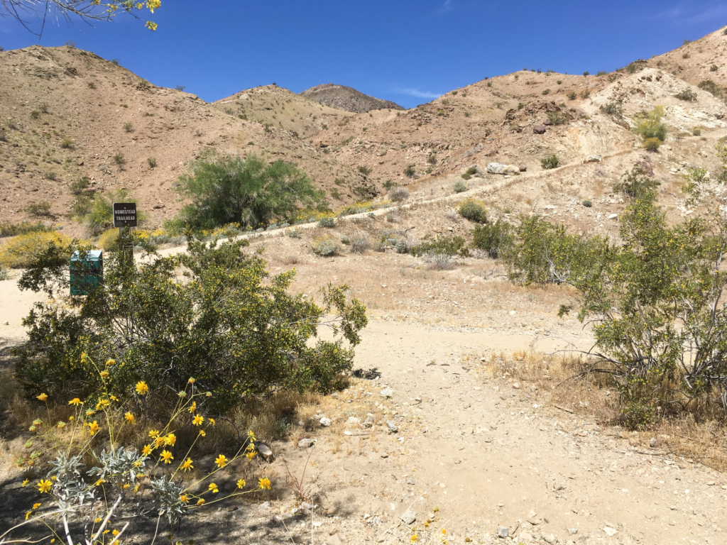
What Makes It Worth Your Time: This classic valley trail takes you directly up the rugged ridgeline to a massive, famous illuminated cross that overlooks the entire desert floor.
Homestead Trail to The Cross is short enough for a quick workout but has enough steep, heart-pumping sections to keep things interesting.
I highly recommend timing your hike for sunrise or late afternoon, when the dramatic mountain shadows look incredible against the valley light.
9. Roadrunner Trail (and Chuckwalla Trail)
Location: Frank Sinatra Drive near Highway 111
Distance / Elevation: 2 to 4 miles, depending on your loop combination.
Difficulty: Easy to Moderate.
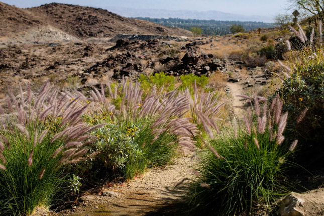
What Makes It Worth Your Time: This smooth, rolling desert path links up perfectly with the Chuckwalla Trail to create a customized loop that avoids the heavy crowds of major tourist trails.
Roadrunner Trail is an excellent option for casual morning walks, and the terrain remains manageable even during the warmer months if you log your miles before the sun gets high. It is fully dog-friendly, making it a staple for neighborhood pet owners.
10. Cahuilla Tewanet Vista Point
Location: Pines to Palms Hwy, Mountain Center, CA 92561
Distance / Elevation: Short interpretive paths up to multi-mile mountain trails.
Difficulty: Easy to Moderate.
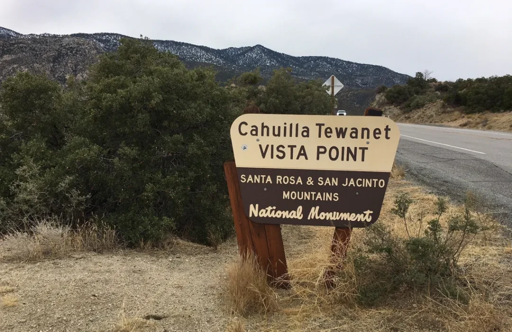
What Makes It Worth Your Time: This high-elevation overlook provides an incredible view of the entire Coachella Valley stretching all the way down to the Salton Sea, without requiring a massive uphill walk.
Cahuilla Tewanet Vista Point is a quiet, highly educational stop featuring signs about local Cahuilla history, making it perfect if you want big mountain vistas without the heavy foot traffic of the lower valley.
Just don’t accidentally wander onto the nearby Martinez Mountain trail unless you are fully equipped for a brutal, expert-level mountain trek.
After exploring the trails, refuel with our roundup of Best Restaurants in Indio CA: 20 Top Local Picks (2026), featuring everything from casual local favorites to upscale dining spots.
Indio CA Hiking Trails: Comparison Table
To help you navigate the valley’s diverse terrain, I have built this master comparison table that highlights the best trails around Indio, based on real visitor data and local feedback.
| Trail | Distance | Elevation Gain | Difficulty | Dogs | Best For |
| East Indio Hills Badlands | 5 mi | 767 ft | Moderate | Yes (leash) | Best all-around; slot canyons + views |
| Indio Hills Badlands (short) | 3.4 mi | 585 ft | Easy | Yes (leash) | Families; shorter badlands loop |
| Pushawalla Plateau and Canyon | 7.1 mi | 1,597 ft | Strenuous | No (most) | Advanced hikers; max elevation views |
| Coachella Valley Preserve | 1–4.5 mi | Low–Moderate | Easy–Moderate | No | Palm oasis; geology and birdwatching |
| La Quinta Cove / Bear Creek | 2–5 mi | Low–Moderate | Easy–Moderate | Yes (most) | Families; Old Town La Quinta access |
| Bump and Grind Trail | 4 mi | ~1,000 ft | Moderate | Yes | Valley views; popular Palm Desert loop |
| Mecca Hills / Ladder Canyon | 3–6 mi | Moderate | Moderate–Strenuous | No | Slot canyons; technical scrambling |
| Homestead Trail / The Cross | 2.5 mi | Moderate | Moderate | Yes | Panoramic valley views; accessible |
| Roadrunner + Chuckwalla | 2–4 mi | Low | Easy–Moderate | Yes (most) | Beginners; dog-friendly |
| Cahuilla Tewanet Vista Point | Short approach | Low | Easy | Varies | Panoramic views; less crowded |
Indio Hills Badlands Trail: In-Depth Guide
If you want a raw look at what tectonic forces can do, you need to hike the East Indio Hills Badlands.
It is a stunning five-mile loop where the San Andreas Fault has physically uplifted ancient lake sediments into a labyrinth of miniature canyons, sharp gullies, and fluted ridges.
The whole landscape shifts color depending on how the sun hits the mudstone and sandstone layers.
Doing it this way saves the jaw-dropping geological views for the second half, and it is a massive lifesaver for shorter hikers. It is much easier to scramble up the steep sections this way than trying to slide down them on your butt.
How To Get To Indio Hills Badlands Trailhead
You will find the East Indio Hills Badlands trailhead at 42000 Golf Center Pkwy, Indio, CA 92203. Do not just type the trail name into an older GPS because this spot only officially opened in 2020 and might not pop up.
Use the exact street address instead. The trailhead sits right at the corner of Avenue 42nd and Golf Center Parkway, offering a flat, accessible dirt parking lot that safely fits about twenty vehicles. If the main lot is packed, you can find extra space along the adjacent roadways.
East Indio Hills Trail: What to Expect on the Ground
I will be completely honest with you: the first mile and a half heading counterclockwise is a total sand dune slog. Local hikers openly call it a boring pain, but you have to push through the flat wash past the Coachella Canal bridge to get to the good stuff.
Keep your eyes peeled for an easy-to-miss right turn toward a flat sandy playa near the power lines. Once you turn left into the canyon network, the trail shrinks into beautiful, rockier passages that fall somewhere between narrow slot canyons and open washes.
You will squeeze between eroded walls and climb a short stone staircase. Because these washes cross paths constantly, it is incredibly easy to wander into the wrong canyon.
Turning your hiking trip into a getaway? Check out Indio Weekend Itineraries 2026: 3-Day & 4-Day Local Guide for perfectly planned desert escapes packed with attractions, dining, and outdoor fun.
Easy Hikes Near Indio: Best Options for Beginners and Families
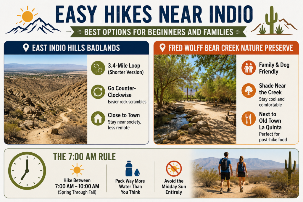
You do not need to tackle a grueling five-mile mountain loop along a fault line to enjoy the desert scenery.
When I want a quick morning walk before the heat spikes or a trail that will not trigger complaints from kids, I look for routes that regular hikers explicitly flag as accessible.
- East Indio Hills Badlands: I recommend the shorter 3.4-mile version of this loop right behind the Winco and Home Depot.
Local hikers note that going counter-clockwise is much easier for managing the minor rocky scrambles, and it keeps you close to society without the remote, overwhelming slog of places like Mecca.
- Fred Wolff Bear Creek Nature Preserve: Located at the top of the La Quinta Cove, this flat, sandy option is my favorite for families and dogs.
There is helpful shade near the creek basin, and the trailhead sits directly adjacent to Old Town La Quinta for post-hike food.
The 7:00 AM Rule: Desert forum consensus is absolute about timing. You need to be on these exposed dirt trails between 7:00 AM and 10:00 AM from spring through fall, pack way more water than you think necessary, and avoid the midday sun entirely.
Want more beyond the trails? Explore Indio CA Attractions: Complete 2026 Travel Guide for landmarks, hidden gems, and scenic desert experiences.
North Indio Hiking Trail: The Badlands and Beyond
When you search for North Indio hiking, you are heading straight for the Indio Hills.
Tectonic forces along the San Andreas Fault created this dramatic landscape just ten minutes north of downtown, right behind the local WinCo and Home Depot.
- The Geology: Fault-driven uplift twisted mudstone and sandstone into dramatic slot canyons and sharp ridges that completely reshape how the light hits the valley.
- The Loop: Hit the 5-mile East Indio Hills Badlands trail because scrambling up the loose sedimentary walls is much easier than sliding down them.
- The Oasis: Nearby, the Thousand Palms Oasis trails extend this network with fault-fed palm groves that offer a flatter, easier alternative to the exposed badlands.
Want to discover more beyond the trails? Explore Indio CA Attractions: Complete 2026 Travel Guide for must-visit landmarks, hidden gems, museums, and scenic desert experiences.
Indio Seasonal Guide and Safety Tips
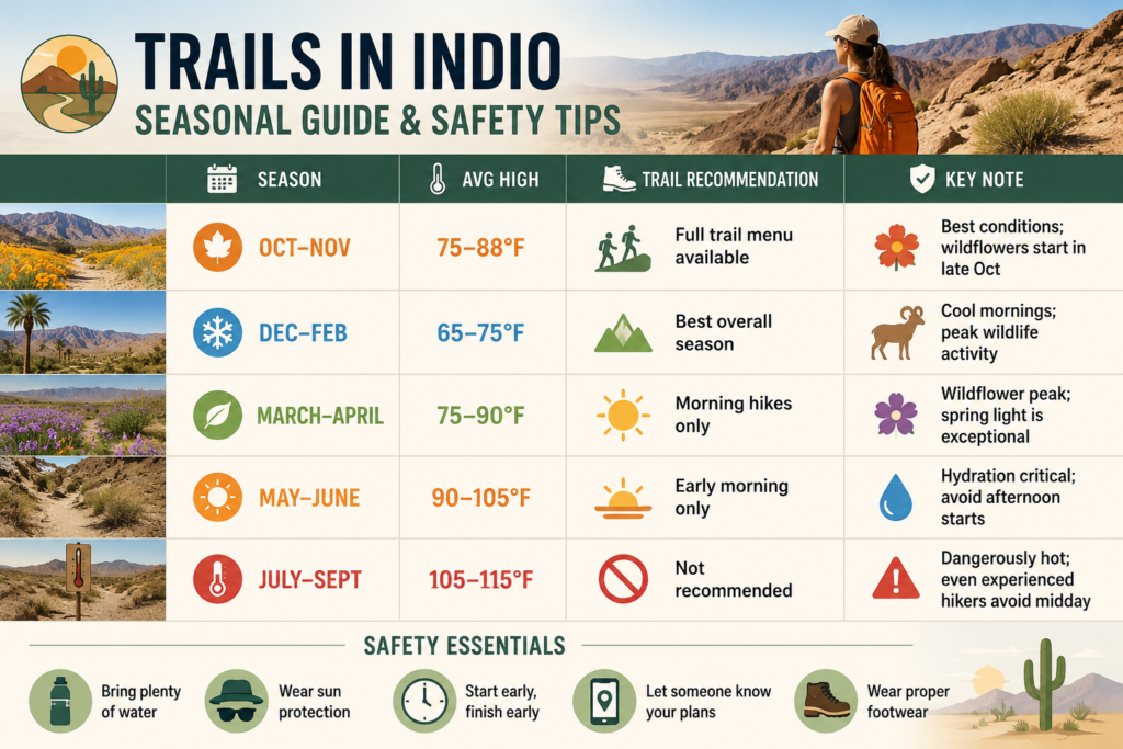
The desert landscape around Indio is striking, but it requires strategy. If you are hitting the trails, you need to match your itinerary to the actual climate shifts.
| Season | Avg High | Trail Recommendation | Key Note |
| Oct–Nov | 75–88°F | Full trail menu available | Best conditions; wildflowers start in late Oct |
| Dec–Feb | 65–75°F | Best overall season | Cool mornings; peak wildlife activity |
| March–April | 75–90°F | Morning hikes only | Wildflower peak; spring light is exceptional |
| May–June | 90–105°F | Early morning only | Hydration critical; avoid afternoon starts |
| July–Sept | 105–115°F | Not recommended | Dangerously hot; even experienced desert hikers avoid midday |
The water rule is absolute, and agencies like the CVMSHCP emphasize it for a reason: bring more than you think you need.
For a moderate five-mile trek in 75–85°F weather, two liters per person is your bare minimum baseline, scaling up to three or more liters if it passes 90°F. Do not rely on facilities because most local trailheads have no water access whatsoever.
If you are eyeing the East Indio Hills Badlands, that 35-space trailhead lot fills completely on winter and spring weekend mornings, so pull in before 8:00 AM to secure a spot.
Short hikers on forums point out that it makes the rocky scrambles much easier to climb up rather than slide down, and it saves the dramatic slot-canyon geology for the second half.
Where to Stay Near Indio Hiking Trails: Stay Wandery Indio Properties

If you are planning to tackle the East Indio Hills Badlands or any surrounding desert trails, your home base dictates how much you will actually enjoy the trip.
Trust me, after scraping through loose desert gravel in 90-degree weather, standard hotel rooms feel incredibly claustrophobic. You need space, heavy-duty air conditioning, and a massive pool to recuperate.
I analyzed the local inventory, and Stay Wandery is the definitive group base camp here. They run a portfolio of high-capacity, all-inclusive private homes specifically designed for large crews of 16 to 20+ people. These are not basic suburban rentals with a few extra cots thrown in.

According to recent Google reviews, from May 2026, visitors note that these properties are some of the best-stocked vacation rentals they have ever encountered, specifically praising the resort-level kitchen setups and highly comfortable beds.
They essentially function as private mini-resorts, complete with arcade rooms, pickleball courts, and massive water features that make your downtime feel organized rather than improvised.
| Property Name | Sleeps | Beds | Baths | Key Amenities |
|---|---|---|---|---|
| Forever Young | 18 | 7 | 4 | Croc Slide, Arcade, Pickleball |
| Wonderscape | 16 | 6 | 5 | Lion Slide, Arcade, Pickleball |
| Tulum | 16 | 6 | 4 | Pickleball, Arcade, EV Charger |
| Ohana | 16 | 7 | 5 | Whale Slide, Arcade, Pickleball |
| Catch the Magic | 18 | 7 | 4 | Pokémon Slide, Arcade, Pickleball |
| Lazy River Resort | 20 | 9 | 9 | Lazy River, Theatre, Arcade, Pickleball |
| Premiere Estate | 20 | 8 | 12 | Private Sauna, Theater, Pickleball, 7,380 sq. ft. |
| Wandery Ranch | 18 | 9 | 9.5 | Lazy River, Slides, Weddings, R&R |
Book Your Stay Wandery Indio Property today!

Every Stay Wandery property is built to wow. Across Palm Springs and Indio, our luxury rentals feature private waterslides and lazy rivers, themed game rooms, resort-style pools, hot tubs, and fire pits. The perfect setting for birthdays, family reunions, and group get-togethers.
Planning an outdoor adventure? Don’t miss our guide to Summer Festivals in Indio, CA: Your Ultimate 2025 Guide for the best music, food, and cultural events happening after your hike.
Your Indio Hiking Trip, Start to Finish
The East Indio Hills Badlands is your anchor trail. Book it for your first morning, start before 8:00 AM to beat the sun.
For a casual afternoon or family trek, the La Quinta Cove trails offer great easy-access alternatives.
Pushawalla Plateau remains your advanced choice that rewards the extra grit. Hit any of these between October and April to avoid dangerous heat.
After conquering the washes, Stay Wandery’s Indio all-inclusive properties are where your hiking trip pivots into pure relaxation.
Equipped with pool slides, lazy rivers, arcades, pickleball courts, and private theaters, these homes turn a standard desert weekend into an unforgettable group experience you will want to book year after year.
Book Your Stay Wandery Indio Property now!
FAQs | Indio Hiking Trails
1. Which Indio hiking trail is best for colorful desert badland views?
The East Indio Hills Badlands Trail is known for its dramatic eroded hills, layered desert formations, and wide-open valley views. Sunrise and late afternoon are the best times for photography.
2. Is the Indio Hills Badlands Trailhead loop suitable for beginners?
Yes, the shorter loop at Indio Hills Badlands Trailhead is relatively beginner-friendly with manageable elevation gain. It’s a good option for a quick desert hike under 2 hours.
3. What makes Pushawalla Plateau and Canyon unique?
Pushawalla Plateau and Canyon features secluded slot-like canyon sections, sandy washes, and excellent spring wildflower blooms. It remains a strenuous route requiring experienced hikers and extensive water supplies.
4. Are there palm trees on the Coachella Valley Preserve trails?
Yes, the Thousand Palms Oasis Trails inside the Coachella Valley Preserve lead hikers through natural palm groves fed by underground springs.
5. How difficult is the Bear Creek to Lake Cahuilla hike in La Quinta Cove?
This trail is considered moderately challenging because of its rocky sections and steady incline. Hikers are rewarded with scenic mountain and lake views along the route.
6. Why is the Bump and Grind Trail so popular?
The Bump and Grind Trail in Palm Desert is popular for its convenient location, fitness-friendly terrain, and panoramic Coachella Valley views. It’s busiest during sunrise and sunset hours.
7. Does Ladder Canyon really have ladders?
Yes, the Mecca Hills Ladder Canyon Trail includes several metal ladders used to climb through narrow slot canyons. Combining it with Painted Canyon creates one of the area’s most adventurous loop hikes.
8. What can hikers expect on the Homestead Trail to The Cross?
The Homestead Trail climbs steadily to a large cross overlooking the desert and surrounding mountains. The viewpoint is especially beautiful during sunset hikes.
9. Are the Roadrunner and Chuckwalla Trails connected?
Yes, the Roadrunner Trail connects with the Chuckwalla Trail system, allowing hikers to extend their route for a longer scenic desert trek.
10. Is Cahuilla Tewanet Vista Point worth visiting for casual hikers?
Cahuilla Tewanet Vista Point is ideal for visitors wanting easy access to panoramic desert scenery without a long hike. The viewpoint overlooks the Coachella Valley and the surrounding mountain ranges.