

Written by the Stay Wandery Editorial Team | Luxury Vacation Rental Properties, Sedona, Arizona | Updated August 2026
This guide is based on our experience as the team behind Stay Wandery in Sedona. Guests ask us constantly which drives are worth their time, which roads actually need a high-clearance vehicle, and which ones a standard rental car can handle without trouble. What follows combines that pattern with research into current road conditions, pass requirements, and route specifics so you can plan your driving time here with confidence.
Disclosure: Stay Wandery properties are our own vacation rentals, so they are featured because we know them best through daily operations and guest feedback. We also encourage you to look into the other route and lodging options mentioned throughout this guide. Information reflects conditions as of August 2026, though road conditions and seasonal access shift with weather. We review and update this guide regularly to keep it accurate.
Sedona Scenic Drives: Every Route Worth Taking
Sedona scenic drives range from a fully paved federal byway that any rental car can handle to a rutted forest road that will strand a sedan within the first few miles, and knowing which is which before you leave matters more than most visitors realize.
Guests constantly reach out to us trying to make sense of conflicting online recommendations regarding four-wheel-drive routes.
We built this guide to set the record straight, giving you clear details on road surfaces, pass rules, and schedules so you can plan your day with confidence.
Sedona Scenic Drive Map: How the Routes Connect
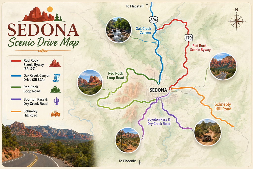
Before getting into each route individually, here’s how the main scenic drives around Sedona compare at a glance.
| Route | Distance | Vehicle Needed | Time | Best For |
| Red Rock Scenic Byway (SR 179) | Approximately 7.5 miles through town | Any vehicle | 20 to 40 minutes | First-time visitors, quick highlights |
| Oak Creek Canyon Drive (SR 89A) | Approximately 28 to 30 miles to Flagstaff | Any vehicle | 45 minutes to 1 hour | Fall color, forested canyon scenery |
| Red Rock Loop Road | Approximately 8 to 10 mile loop | Any vehicle, caution on last mile | 1 to 2 hours | Cathedral Rock views, Crescent Moon |
| Boynton Pass and Dry Creek Road | Approximately 10 to 12 mile loop | Standard car, slow on dirt sections | 1.5 to 2 hours | Boynton Canyon, backcountry views |
| Schnebly Hill Road | Approximately 12 miles to I-17 exit (30 mi south of Flagstaff) | High-clearance 4WD only past pavement | 1.5 to 3 hours | Off-road enthusiasts, jeep tours |
Each of these gets its own detailed breakdown below, including exactly where the pavement ends on the routes that matter.
Red Rock Scenic Byway (SR 179): Sedona’s Most Iconic Scenic Drive
The Red Rock Scenic Byway, running along State Route 179 from the Village of Oak Creek into Sedona, holds both National Scenic Byway and All-American Road designations from the U.S. Department of Transportation, one of the highest honors given to a scenic route in the country.
- The drive covers approximately 7.5 miles from the I-17 junction at exit 298 into town, entirely paved and suitable for any vehicle.
- Major viewpoints along the route include Bell Rock, Courthouse Butte, and Cathedral Rock, with marked pullouts for photos at several points.
Local Tip: Most guests treat SR 179 as a pass-through on their way into town, but the pullouts here reward an unhurried pace.
If you have even 20 extra minutes, stopping at two or three of the marked viewpoints turns a routine drive into one of the best short scenic drives in Sedona without adding real time to your day.
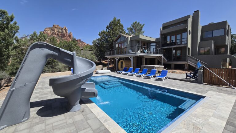
Our Sedona homes are the rare kind that give you more than the view. Every home has its own pool, spa and game room, five of the six are a short walk from Uptown Sedona, and all of them welcome dogs. Built for group trips, family reunions, and red rock weekends.
Oak Creek Canyon Drive on Highway 89A: Best Scenic Drive Between Sedona and Flagstaff
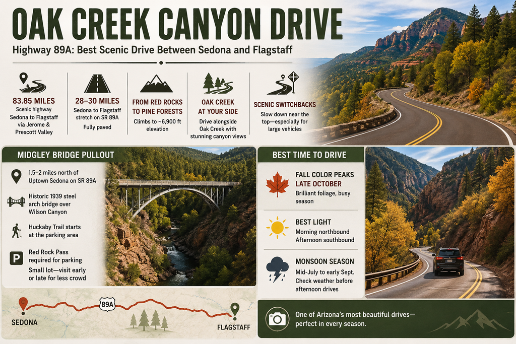
State Route 89A through Oak Creek Canyon is widely considered the best scenic drive connecting Sedona to Flagstaff, and it’s part of a broader 83.85-mile scenic highway stretching from Sedona through Jerome, Prescott Valley, and Flagstaff.
- The Sedona-to-Flagstaff stretch alone covers approximately 28 to 30 miles, fully paved, climbing from Sedona’s red rock terrain into Flagstaff’s pine forest at approximately 6,900 feet elevation.
- The road threads alongside Oak Creek itself for much of the drive, with forest canopy overhead that turns bright gold and red during fall color season.
- A series of switchbacks near the top of the canyon requires a slower pace, particularly for larger vehicles or anyone unfamiliar with mountain driving.
Midgley Bridge Pullout: A Quick Stop Worth the Detour
- Midgley Bridge sits approximately 1.5 to 2 miles north of Uptown Sedona on SR 89A, a steel deck arch bridge completed in 1939 spanning Wilson Canyon.
- The pullout offers views of both the bridge itself and the canyon below, with the Huckaby Trail beginning right at the parking area for anyone wanting a short walk down toward the creek.
- Parking here requires a Red Rock Pass, and the lot is small enough that early morning or late afternoon visits avoid the worst of the midday crowding.
Best Time to Drive Through Oak Creek Canyon: Season and Time of Day
- Fall color typically peaks in late October, when the canyon’s oak and maple trees turn against the red rock backdrop, drawing some of the heaviest seasonal traffic of the year.
- Morning drives northbound catch the canyon walls lit by direct sun, while afternoon light works better heading south back toward Sedona.
- Post-fire flash-flood risks run through monsoon season (mid-July through early September), bringing sudden closures and hazardous road conditions rather than just visibility issues.
Key stops including West Fork Trail, Call of the Canyon, Grasshopper Point, Banjo Bill, Bootlegger, Encinoso, and the 100-ft drainage buffer remain closed; always verify current Forest Service access before heading out.
Sedona Scenic Drive from Flagstaff: Reversing the Oak Creek Canyon Route
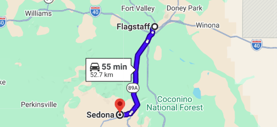
Driving this route from Flagstaff toward Sedona is equally popular, and a few details change depending on direction.
- The elevation drop from Flagstaff, sitting approximately 2,600 feet higher than Sedona, means southbound drivers experience the more dramatic transition, watching pine forest give way to red rock in under an hour.
- Southbound traffic handles the canyon’s switchbacks as descending turns rather than climbing ones, which some drivers find easier, and others find requires more attentive braking.
- Starting from Flagstaff in the morning puts you into Sedona with a full day still ahead, making this a popular way to begin a Sedona day trip for visitors already staying in northern Arizona.
Phoenix to Sedona Scenic Route: The Drive Itself as Part of the Trip
For visitors coming from the Phoenix area, the standard route via Interstate 17 isn’t purely functional.
The final stretch delivers scenery worth treating as part of the trip rather than something to get through.
- Interstate 17 north covers most of the distance through open high desert, with the final 15 minutes on SR 179 delivering the payoff as red rock formations fill the windshield.
- An alternate, slightly longer route follows I-17 to AZ-260 through Cottonwood, then AZ-89A into Sedona, adding scenery through the Verde Valley in exchange for extra time.
- Elevation climbs from Phoenix’s low desert to Sedona’s approximately 4,350 feet, with temperatures running approximately 10 to 15°F cooler by the time you arrive, noticeable even before you’ve left the car.
Red Rock Loop Road: Crescent Moon, Cathedral Rock Viewpoint Drive, and Red Rock State Park
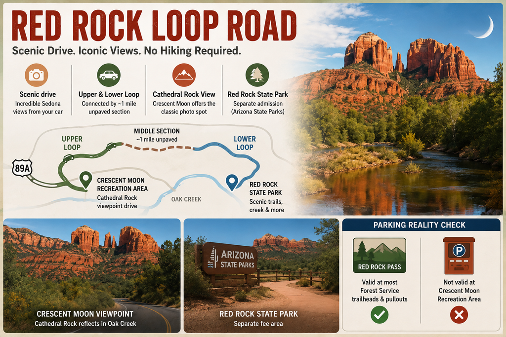
Red Rock Loop Road delivers one of the best views in Sedona by car without requiring any hiking at all, making it a favorite for visitors short on time or mobility.
- The route splits into Upper and Lower Red Rock Loop Road, connected by a short unpaved middle section of roughly a mile that can get muddy after rain but is manageable at a slow pace for most passenger vehicles.
- Along the way, Crescent Moon Recreation Area offers the classic Cathedral Rock viewpoint drive, where the formation reflects across Oak Creek in one of the most photographed scenes in Arizona.
- Red Rock State Park sits near the end of the loop, with its own separate admission fee since it’s managed by Arizona State Parks rather than the U.S. Forest Service.
Parking Reality Check: The Red Rock Pass that covers most Forest Service trailheads and pullouts is not valid at Crescent Moon Recreation Area, which charges its own separate fee.
It’s also not valid at West Fork, Grasshopper Point, Beaver Creek, or Lower Lake Mary (note: Grasshopper Point, West Fork, and Call of the Canyon are currently closed to all access), so don’t assume one pass covers every stop.
Check signage at each location, since the fee structure varies by site even within a single scenic drive.
Boynton Pass Road and Dry Creek Road: A Scenic Loop Through Red Rock Backcountry
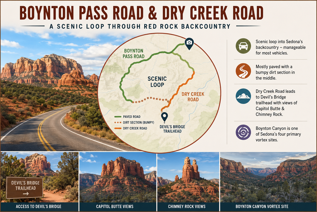
This loop combines Boynton Pass Road and Dry Creek Road into a route that reaches deeper into Sedona’s backcountry than the main paved byways, while still staying manageable for most standard vehicles.
- The road is mostly paved, with a dirt section through the middle of the loop that can be bumpy but is passable for a standard passenger car outside of heavy monsoon conditions.
- Dry Creek Road provides access to the Devil’s Bridge trailhead parking area, along with views of Capitol Butte and Chimney Rock along the way.
- Boynton Canyon itself, visible from pullouts along this route, is considered one of Sedona’s four primary vortex sites and draws visitors interested in the area’s spiritual significance as much as its scenery.
Choose this drive if: you want backcountry views without needing a 4WD vehicle, and you’re comfortable with a short unpaved stretch driven slowly.
Skip this drive if: it’s actively raining or has rained recently, since the unpaved middle section turns slick and muddy under wet conditions.
Schnebly Hill Road: Can You Drive a Sedan on This Route
This is one of the most-asked questions we hear from guests planning their scenic drives, and the answer is a clear no beyond a certain point.
- The road starts paved for roughly the first mile off SR 179, then transitions to a rough, rutted forest road for the remaining distance, approximately 12 miles total to reach I-17 at the Schnebly Hill interchange (roughly 30 miles south of Flagstaff proper).
- A high-clearance 4WD vehicle is required past the pavement. Note that the unpaved upper section is seasonally gated and closed by the Coconino National Forest (typically from mid-December through mid-April depending on snow and mud conditions); check forest service road status before attempting.
Despite the vehicle requirements, this remains one of the most rewarding drives in the area for those equipped for it, delivering panoramic views that the paved routes simply can’t match from the same vantage points.
What Visitors Often Don’t Realize: Guests often assume “unpaved” means merely bumpy, but Schnebly Hill Road is a fundamentally different category of driving than the mostly paved Red Rock Loop or Boynton Pass routes.
If you don’t have a high-clearance 4WD vehicle, a guided jeep tour or a walk along the parallel hiking trail delivers the same views without the risk.
Stops longer than approximately 15 minutes along the way require a Red Rock Pass.
4×4 Trails and Off-Road Driving in Sedona AZ: When You Need More Than a Rental Car
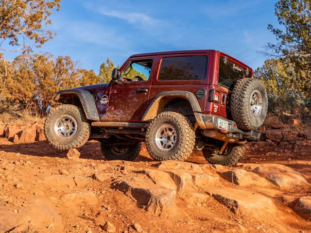
Beyond Schnebly Hill Road, Sedona has several dedicated 4×4 routes that go well past what any scenic drive guide would call a standard road.
- Routes like Broken Arrow and Diamondback Gulch require significant vehicle lift and off-road experience, well beyond what a stock high-clearance vehicle can handle.
- Local outfitters rent Jeeps by the day, typically running approximately $300 per day, for visitors wanting to attempt these routes without their own equipment.
- Guided jeep tours remain the most accessible way to experience Sedona’s true 4×4 terrain, since they remove both the vehicle requirement and the navigation guesswork.
This category of driving is a different experience from the paved and lightly-unpaved scenic drives covered elsewhere in this guide, and it’s worth treating as its own separate activity rather than something to add casually onto a day already built around SR 179 or Oak Creek Canyon.
Best Views in Sedona by Car: Bell Rock, Cathedral Rock, and Airport Mesa Pullouts
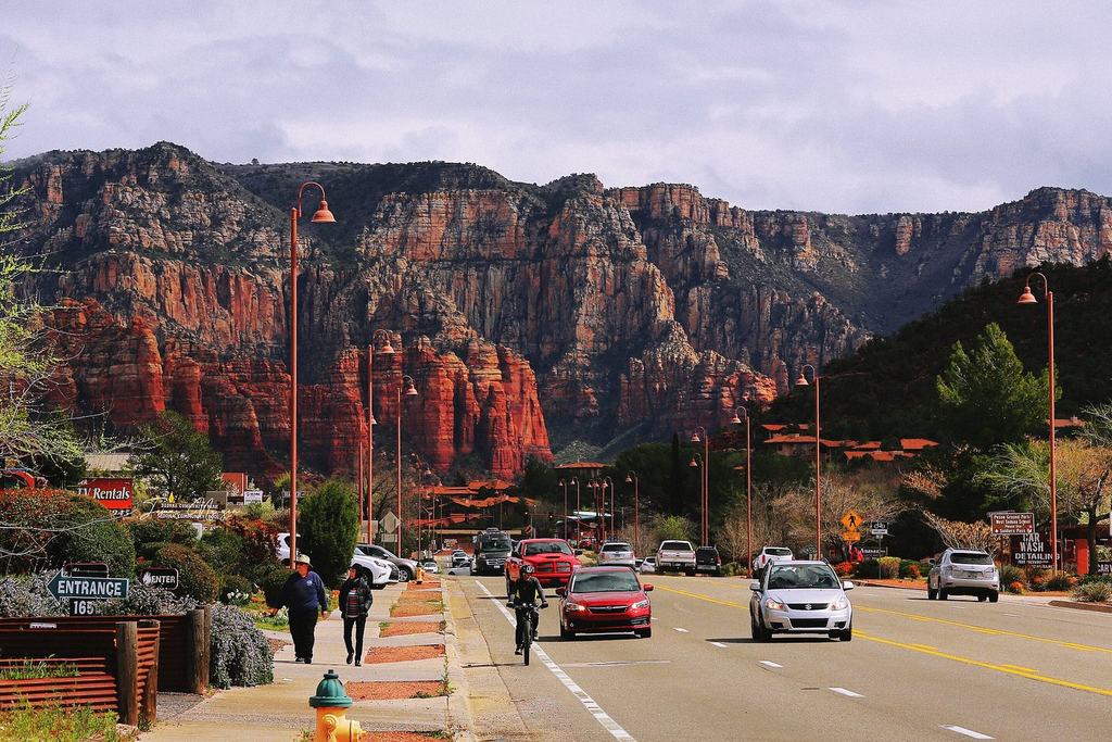
Several of Sedona’s most photographed views are reachable entirely by car, without requiring a hike, which matters for visitors with mobility limitations or simply limited time.
- Bell Rock scenic view pullout sits directly along SR 179, giving a clear formation view without leaving the byway.
- Cathedral Rock viewpoint drive via Red Rock Loop Road and Crescent Moon Recreation Area delivers the formation’s reflection across Oak Creek, arguably the more dramatic angle compared to viewing it from the trailhead side.
- Airport Mesa requires a short walk from its parking lot rather than a true drive-up view, but the lot itself sits close enough that it functions as a car-accessible stop for most visitors.
Best For: Visitors traveling with young children, older family members, or anyone managing a physical limitation will find these car-accessible viewpoints deliver much of what Sedona is known for without requiring trail mileage.
Pairing two or three of these stops into a single afternoon covers a surprising amount of Sedona’s signature scenery.
Chapel of the Holy Cross Drive: A Short Detour Worth Adding to Any Route
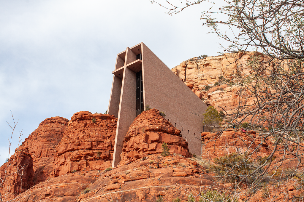
The Chapel of the Holy Cross sits just off SR 179, making it an easy addition to a Red Rock Scenic Byway drive rather than a separate trip.
- The access road climbs a short distance from SR 179 to the chapel’s parking area, itself giving views back across the valley.
- Admission is free, with hours running 9 a.m. to 5 p.m. daily, and the small lot fills quickly during midday hours on weekends.
Sedona Sunset Scenic Drive: Where to Time Your Route for Golden Hour
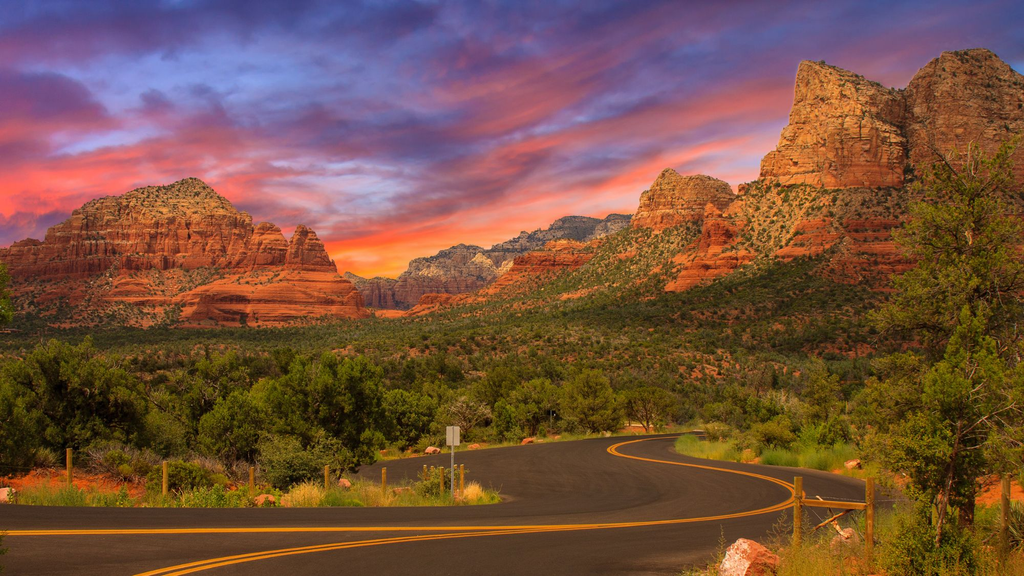
Several of the drives covered in this guide double as excellent sunset routes if you time your departure right.
- Airport Mesa offers one of the most reliable sunset views from its paved Scenic Lookout, best reached 45 minutes to an hour before sunset given limited parking.
- Red Rock Loop Road, driven westbound in the late afternoon, catches direct light on the formations along Upper Red Rock Loop Road.
- SR 179 southbound toward the Village of Oak Creek puts the sun at your back in late afternoon, lighting Bell Rock and Courthouse Butte from the most flattering angle.
Slide Rock State Park Drive: A Stop Along the Oak Creek Canyon Route
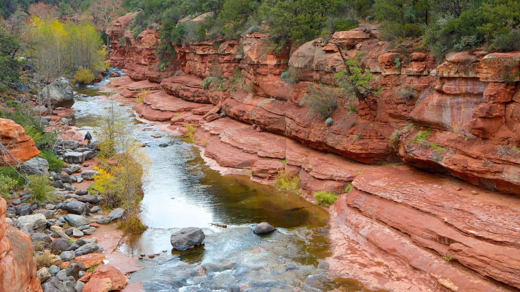
Slide Rock State Park sits directly on the Oak Creek Canyon drive, roughly a third of the way toward Flagstaff, making it a natural stop rather than a separate destination.
- The park is managed by Arizona State Parks rather than the Forest Service, so a Red Rock Pass does not cover admission here.
- Its parking lot fills quickly on summer weekends, and roadside parking along SR 89A is not permitted once the lot is full.
- The swim area was affected by flood-safety closures following the 2026 Pocket Fire and closed until 1 October 2026.
Sedona Shuttle Scenic Stops: Can You See These Drives Without a Car
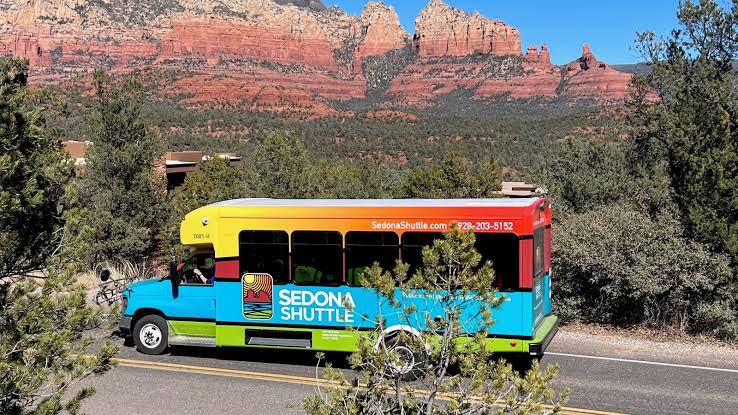
The free Sedona Shuttle covers several trailheads, but it’s built for hiking access, not the scenic drives themselves.
- Shuttle trailhead stops include Mescal, Dry Creek Vista, Soldier Pass, Cathedral Rock, and Little Horse, running Thursday through Sunday from approximately 7 a.m. to 5:30 p.m., with daily service during peak season.
- The shuttle does not run the full length of SR 179, Oak Creek Canyon, or Red Rock Loop Road, so seeing these routes as actual scenic drives requires a car regardless of shuttle availability.
- As of this update, Routes 11 and 14, serving Dry Creek and Mescal, and Soldier Pass respectively, are not currently operating, which affects trailhead access more than it affects the scenic driving routes covered in this guide.
Sedona Scenic Drives Itinerary: Combining Routes Into a Half Day or Full Day
Guests often ask how to string these drives together, so here’s how we typically frame the choice.
- Half-day itinerary: the Red Rock Scenic Byway, a detour to the Chapel of the Holy Cross, and either Red Rock Loop Road or a short stretch into Oak Creek Canyon to Midgley Bridge, totaling approximately 3 to 4 hours including stops.
- Full day itinerary: everything in the half-day version, plus the complete Oak Creek Canyon drive to Flagstaff and back, or Boynton Pass and Dry Creek Road if backcountry views interest you more than the canyon.
To help build the rest of your itinerary, check out our full Sedona Travel Guide for top dining, activity, and trail recommendations.
Choose the half-day version if: you’re combining scenic drives with a hike or other activity on the same day.
Choose the full-day version if: the driving itself is the primary activity, or you’re specifically chasing fall color in Oak Creek Canyon.
Stay Wandery, Sedona: Luxury Rental Properties Positioned for Sedona’s Best Scenic Drives
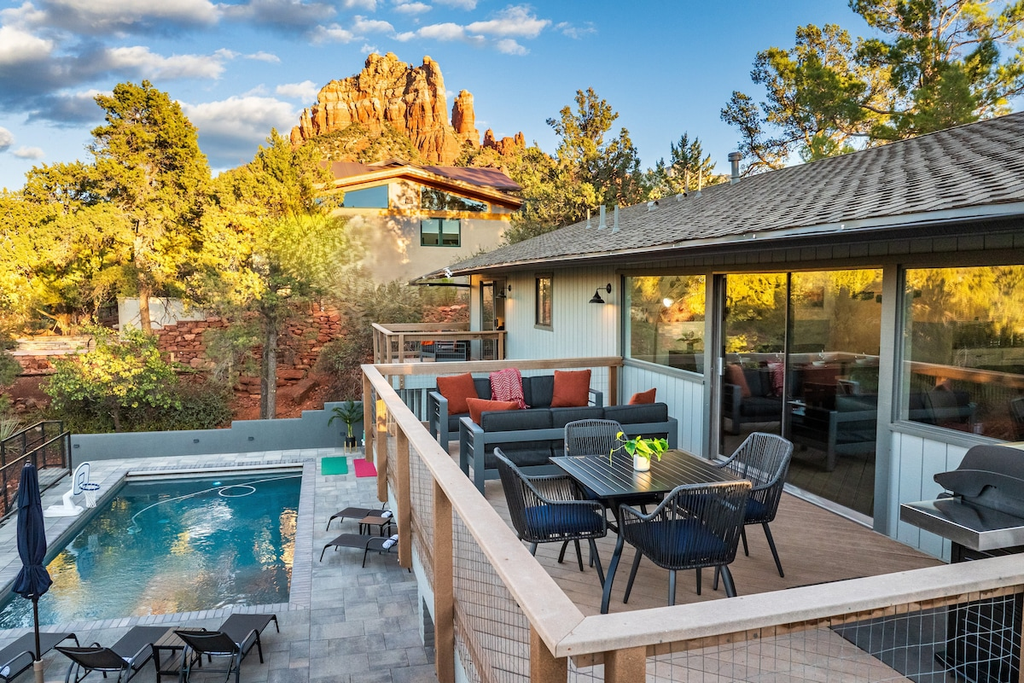
We operate five luxury vacation rental properties across Sedona, each positioned differently relative to the routes covered in this guide.
| Property | Sleeps | Standout Features | Location / Access |
| Uptown EPIC! | Up to 25 | 2 homes, 2 heated pools & spas, 2 kitchens, 2 game rooms | Walk to Uptown, near Oak Creek Canyon |
| Uptown Sparks! | Up to 13 | 5 bedrooms, heated pool & hot tub, fire table, fenced yard | Near Red Rock Scenic Byway |
| Starview Sedona! | Up to 12 | 4 bedrooms, large heated pool, 8-person hot tub, arcade, pool & ping pong | Near Tlaquepaque & Red Rock Loop Road |
| SkyLine Sedona! | Up to 12 | 5 king bedrooms, Red Rock views, 2 firepits | Central location for major routes |
| Uptown Splash! | Up to 12 | 5 bedrooms, heated pool & hot tub/swim spa, studio suite, putting green | Near Uptown & Oak Creek Canyon |

Stacking two or three drives into a single day is simple here, as all five locations offer fast access to these roads, just one of the reasons we hold a 4.4-star Google rating.
Getting the Most Out of Sedona’s Scenic Routes
Sedona scenic drives range from a fully paved federal byway suitable for any rental car to backcountry routes that require a high-clearance 4WD vehicle, and knowing which is which saves real frustration once you’re here.
Start with the Red Rock Scenic Byway and Oak Creek Canyon for the easiest, most rewarding routes, then add Red Rock Loop Road or Boynton Pass if you want backcountry views without needing off-road equipment.
To make the most of your time in Red Rock Country, see our recommendations in How Many Days in Sedona.
Staying at Stay Wandery? Let our local experts map out these drives to complement your broader travel plans.
Discover which of our five Sedona properties offers the best access to your favorite routes, and remember to confirm unpaved road conditions ahead of time, as sudden weather can alter accessibility.
FAQs | Sedona Scenic Drives: Every Route Worth Taking
1. What is the best scenic drive in Sedona for a first-time visitor?
The Red Rock Scenic Byway along SR 179 is the easiest recommendation, since it’s fully paved, holds an All-American Road designation, and delivers views of Bell Rock, Courthouse Butte, and Cathedral Rock in under 30 minutes. It also connects naturally to a Chapel of the Holy Cross detour, making it simple to extend into a longer half-day itinerary without needing to plan a separate trip or worry about vehicle requirements beyond a standard rental car.
2. Can you drive a sedan on Schnebly Hill Road?
No, not beyond the first mile or so of pavement. The remaining stretch is a rough, rutted forest road that requires a high-clearance 4WD vehicle, and multiple recent visitors describe standard cars and even stock SUVs getting stuck or turning back partway. A rented Jeep or a guided jeep tour is the practical way to experience this route without your own off-road vehicle, and it’s worth budgeting the extra cost rather than risking a rental car on the unpaved section.
3. Do I need a Red Rock Pass for Sedona’s scenic drives?
It depends on where you stop. A pass, running approximately $5 for a day or $15 for a week, covers most Forest Service pullouts and trailheads for stops longer than about 15 minutes, but it’s not valid at Crescent Moon Recreation Area, West Fork, Grasshopper Point, Beaver Creek, or Lower Lake Mary, each of which charges separately. Slide Rock State Park is a state park entirely outside this system, so plan for a separate admission fee there.
4. What is the best scenic drive between Sedona and Flagstaff?
State Route 89A through Oak Creek Canyon is the clear answer, covering approximately 28 to 30 miles of forested canyon scenery with Midgley Bridge and the Oak Creek Vista overlook along the way. The drive works well in either direction, though many visitors prefer starting in Flagstaff and descending into Sedona for the more dramatic elevation transition as pine forest gives way to red rock over the course of less than an hour.
5. Is there a scenic route from Phoenix to Sedona, or is it just highway driving?
The standard route via Interstate 17 covers mostly open desert, but the final 15 minutes on SR 179 deliver genuine scenery as red rock formations come into view ahead of you. An alternate route through Cottonwood on AZ-260 and AZ-89A adds Verde Valley scenery in exchange for extra driving time, which is worth considering if the drive itself is meant to be part of the experience rather than just transportation.
6. Can you see Sedona’s scenic drives without a car, using the shuttle?
Not really. The free Sedona Shuttle covers several hiking trailheads on a Thursday through Sunday schedule, but it doesn’t run the length of SR 179, Oak Creek Canyon, or Red Rock Loop Road, so experiencing these as actual scenic drives requires a car regardless of shuttle availability within town. The shuttle is built around trail access rather than sightseeing along the byways themselves, and no current route substitutes for driving these roads yourself.
7. What’s the best time of day to drive through Oak Creek Canyon?
Morning works well for northbound drives, catching direct light on the canyon walls, while afternoon light favors the southbound return toward Sedona. Fall color typically peaks in late October, drawing the heaviest seasonal traffic of the year, so an early morning departure helps avoid both crowds and the tightest parking at pullouts like Midgley Bridge during that particular stretch of weeks each autumn, especially on weekends when day-trippers add to the usual traffic.
8. Are there 4×4 trails in Sedona besides Schnebly Hill Road?
Yes, routes like Broken Arrow and Diamondback Gulch go well beyond what Schnebly Hill Road requires, needing significant vehicle lift and real off-road experience to attempt safely. Most visitors access these through a guided jeep tour or a rented Jeep, typically running approximately $300 per day, rather than attempting them in a personal vehicle without the right equipment, ground clearance, or local knowledge of the terrain, since the risk of vehicle damage is real.
9. How does driving Sedona’s scenic routes change in winter?
Winter brings the lightest crowds of the year to every route in this guide, but overnight lows of approximately 28 to 35°F can create ice on shaded stretches, particularly in Oak Creek Canyon’s higher elevations near the switchbacks. Schnebly Hill Road upper unpaved section is seasonally gated and fully closed during winter (typically mid-December through mid-April, governed by Coconino National Forest); during open months, wet weather makes 4WD strictly required.
10. What’s the best scenic drive in Sedona for sunset?
Airport Mesa’s paved Scenic Lookout is the most reliable option, best reached 45 minutes to an hour before sunset given its limited parking availability on any given evening. Red Rock Loop Road driven westbound in late afternoon and SR 179 driven southbound toward the Village of Oak Creek both catch flattering late-day light on the major rock formations as well, making either a solid backup if Airport Mesa’s lot is already full.
Sources Consulted:
- U.S. Department of Transportation National Scenic Byway and All-American Road designation for State Route 179
- U.S. Forest Service Coconino National Forest official trail and scenic drive pages (fs.usda.gov)
- Arizona State Parks official Slide Rock State Park and Red Rock State Park fee information
- City of Sedona and Visit Sedona official scenic drive and Red Rock Pass information
- Sedona Shuttle official route and schedule information
- NOAA National Centers for Environmental Information, 1991-2020 climate normals, station USC00027708
- Our team’s own operational experience hosting guests at Stay Wandery, Sedona