
Written by the Stay Wandery Editorial Team | Luxury Vacation Rental Properties, Sedona, Arizona | Updated November 2026
This guide is based on our experience as the team behind Stay Wandery in Sedona. Every week, guests ask us to sketch out a driving route on a napkin before they head out for the day, so we finally put that napkin map into a proper guide. The recommendations here combine our firsthand local knowledge with research into current passes, closures, and drive times to help you plan a self-guided trip through Sedona.
Disclosure: Stay Wandery properties are our own vacation rentals, so they are featured because we know them best through daily operations and guest feedback. We also encourage you to explore the other accommodations mentioned throughout this guide to find the stay that best matches your travel plans. Road, trail, and pricing information reflects the latest data available as of November 2026, though closures and fees can change. We review and update this guide regularly to keep the information accurate.
Self-Guided Sedona Driving Tour (Free Route Map)
A Sedona self-driving tour does not require an app, a guide, or a ticket, and that surprises most first-time visitors who email us before their trip.
Guests staying at Stay Wandery often ask us the same question during check-in: “Do we really need to book a tour, or can we just drive ourselves around?”
The honest answer is that Sedona’s best scenery sits along public highways, and you can see nearly everything worth seeing from behind your own wheel, for the cost of gas and a parking pass.
This guide lays out the actual route, mile by mile, along with current pricing, parking realities, and the road closures in effect this season. We also flag where a paid audio tour actually adds value, and where it does not.
Can You Tour Sedona On Your Own? What Our Guests Ask Us
Yes. Sedona is built around two main highways, SR 179 and SR 89A, and both are paved, well signed, and open to any rental car or personal vehicle.
You do not need four-wheel drive for the core scenic loop.
A few things do trip people up:
- Cell signal drops in sections of Oak Creek Canyon and on Boynton Pass Road, so download offline maps before you leave your rental.
- Some trailhead parking lots fill by mid-morning on weekends, which is a parking problem, not a driving problem.
- A handful of hikes and picnic areas are closed right now because of wildfire recovery work, covered in detail below.
Beyond that, a Sedona self driving tour is one of the simplest self-guided road trips in the Southwest.
Most of what people pay $ 80 to $ 150 for in a van tour to see is visible from a public pull-off.
Looking for a broader overview of the area? Check out our complete Sedona Travel Guide to plan your entire trip.
Free Sedona Self-Driving Tour Map: What You Actually Get
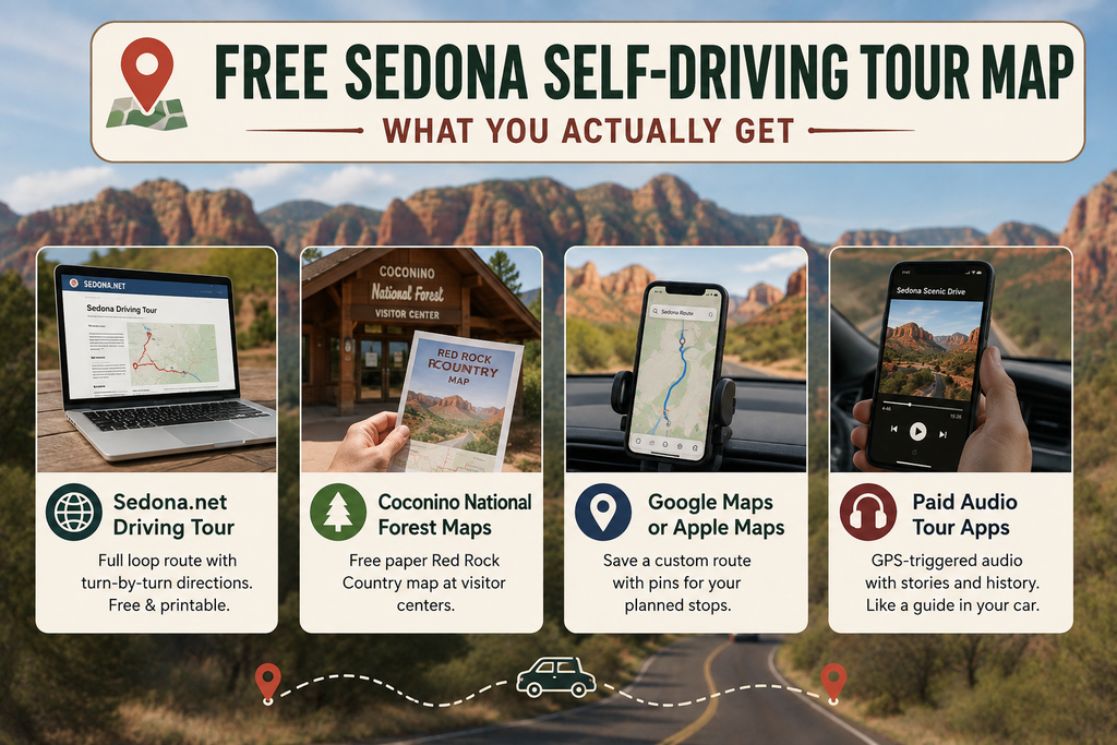
Several sources offer a free Sedona driving tour map, and it helps to know what each one includes before you rely on it.
- Coconino National Forest visitor centers hand out official paper Red Rock Country maps at the South Gateway Visitor Center on SR 179 and the Uptown visitor center.
- Official tourism maps from Visit Sedona, available online and at the official visitor center on Forest Road.
- Google Maps or Apple Maps, saved as a custom route with pins, the option most of our own guests end up using once they know their stops.
- Paid audio tour apps such as Shaka Guide, GuideAlong and Action Tour Guide, which layer narrated history onto GPS-triggered audio, more like a hired guide than a map.
Before You Book: Before you pay for any Sedona self driving tour app, check whether you actually want narration or just directions.
If you already know you want to stop at Bell Rock, Chapel of the Holy Cross and Slide Rock, a free map and a printed list of addresses does the same job.
Paid audio tours earn their price when you want the stories behind what you are looking at, not just the route to get there.
Building A Sedona Self-Guided Itinerary: The Three-Route Framework
We break every Sedona self driving tour itinerary into three separate drives, since combining all of Sedona into one giant loop is how people end up rushing through Oak Creek Canyon at dusk.
Do these as separate outings, on the same day or across two.
Red Rock Scenic Byway: Sedona’s Free Scenic Drive South
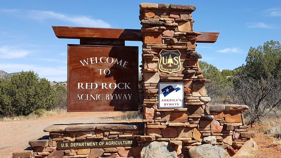
The Red Rock Scenic Byway is the stretch of SR 179 connecting Interstate 17 to Uptown Sedona, a designated National Scenic Byway with All-American Road status.
It runs roughly 7.5 miles and takes about 20 to 25 minutes straight through, or closer to 90 minutes with stops.
Key stops along this route, driving north from the I-17 interchange:
- Red Rock Scenic Byway Visitor Center, Village of Oak Creek, for maps and pass purchases.
- Bell Rock, a short pull-off with a flat, easy walk toward the formation.
- Courthouse Butte, visible from the same pull-off area.
- Chapel Road turnoff, leading to the Chapel of the Holy Cross.
- Tlaquepaque Arts & Shopping Village, on the banks of Oak Creek near the byway’s northern end.
Traffic on this road is heaviest on weekends and holiday afternoons, since it is the main entry point from Phoenix.
Guests staying at Starview Sedona!, one of our Stay Wandery properties with Tlaquepaque within easy reach, often take this drive early morning to skip the worst of the weekend backup.
Oak Creek Canyon Drive: The Route North To Slide Rock and Flagstaff
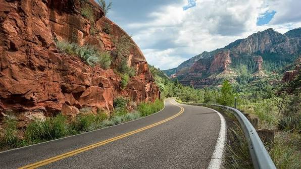
SR 89A north of Uptown Sedona climbs through Oak Creek Canyon toward Flagstaff, about 45 to 60 minutes away depending on traffic and conditions.
This is widely considered one of the best scenic drives in Sedona, forested and distinct from the red rock desert south of town.
Sedona sits at roughly 4,350 feet elevation, while Flagstaff sits around 6,900 feet, so this drive gains close to 2,600 feet.
That change means weather can shift fast, especially in winter when snow closes in above the canyon rim while Sedona stays clear.
West Sedona and the Self-Guided Vortex Tour Loop
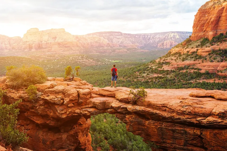
The third route heads west on SR 89A into West Sedona, then north on Dry Creek Road toward Boynton Canyon, looping past Airport Mesa on the way back.
This is the core of any self-guided vortex tour Sedona visitors piece together, covered next.
Self-Guided Vortex Tour Sedona: Driving To Bell Rock, Airport Mesa, Cathedral Rock and Boynton Canyon
Sedona’s four most talked-about vortex sites are all reachable by car, with only a short walk from the parking area to the viewpoint at three of them.
| Vortex Site | Drive From Uptown | Parking Situation | Walk From Car |
| Airport Mesa | Approx. 10 minutes | Small paved lot, fills fast at sunset | Short walk to overlook |
| Bell Rock | Approx. 15 minutes | Large paved lot off SR 179 | Flat, easy access near the road |
| Cathedral Rock (viewpoint) | Approx. 15 minutes | Small lot, closes when shuttle runs | Short walk to base |
| Boynton Canyon | Approx. 20 minutes | Trailhead lot, moderate size | Longer walk if hiking in |
We get asked constantly whether you need to hike to “feel” a vortex. You do not.
Bell Rock and Airport Mesa both offer a vortex experience within a few minutes of the parking area, which is why they are the two most visited stops on any self-guided vortex tour Sedona itinerary.
Cathedral Rock is different. The actual trail is a 1.1-mile round trip rated strenuous, climbing 669 feet from a trailhead at 4,043 feet, with slickrock scrambling.
Most drive-by visitors instead view it from Red Rock Crossing, covered further down.
Boynton Canyon’s full trail runs 6 miles out and back from a trailhead at 4,525 feet, gaining 931 feet, rated moderately challenging.
You do not need to hike all of it, since the road in passes striking canyon walls before you reach the trailhead.
Driving Route To Chapel of the Holy Cross
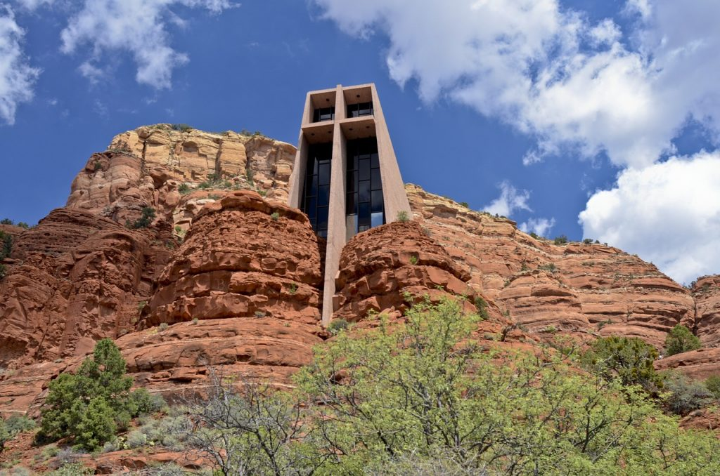
From Uptown Sedona, head south on SR 179 (the Red Rock Scenic Byway) for about 3 miles, then turn onto Chapel Road. The Chapel of the Holy Cross sits roughly 10 minutes from central Sedona by car.
- Admission is free, and the chapel is open daily from 9:00 a.m. to 5:00 p.m. (last entry at 4:45 p.m.), except Good Friday, Easter, Thanksgiving, and Christmas.
- Parking is ample at the base, but the walk up to the entrance is steep, so plan extra time for anyone with mobility concerns.
- A gift shop sits downstairs, and a short Monday evening prayer service is open to the public.
This stop pairs naturally with the byway drive, since Chapel Road branches directly off SR 179.
Airport Mesa Sunset Drive: Timing, Parking and What To Expect
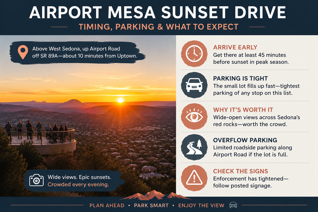
Airport Mesa sits above West Sedona, reached by driving up Airport Road off SR 89A, about a 10-minute drive from Uptown.
The lot is small, and it is the tightest parking situation of any stop on this list once the sun starts dropping.
- Arrive at least 45 minutes before sunset for a parking space in peak season.
- The observation area’s wide view across Sedona’s formations is why it draws a crowd every evening, not only during vortex-focused visits.
- If the small lot is full, limited roadside parking exists along Airport Road, but check posted signage since enforcement has tightened recently.
Guests staying at SkyLine Sedona!, one of our Stay Wandery properties with a central location and wall-to-wall red rock views from the property itself, sometimes watch sunset from their own deck instead, then drive up later once the crowd thins.
Driving Route To Slide Rock State Park Through Oak Creek Canyon
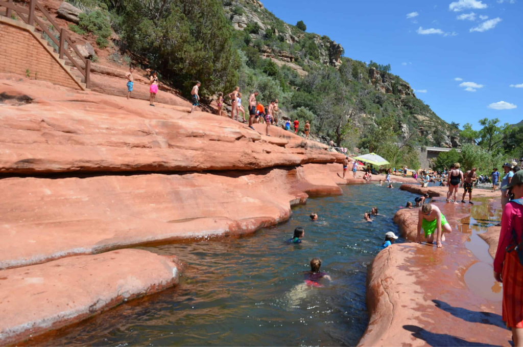
Slide Rock State Park sits about 7 miles north of Sedona on SR 89A, inside Oak Creek Canyon, roughly a 15 to 20 minute drive from Uptown depending on traffic.
- Entrance fees run approximately $10 to $30 per vehicle depending on season and day.
- The park is vehicle-entry only, with no walk-in, bike-in, or drop-off access.
- Parking fills early in summer, often by 10 a.m. on weekends, and staff holds vehicles at the gate once the lot is full.
- A Red Rock Pass is not valid here. Slide Rock charges its own separate state park entrance fee.
Important update for August 2026: the Oak Creek swim area is closed until October 1, 2026, due to wildfire recovery work following the Pocket Fire.
Vehicle entry to the park continues normally, but check current conditions before planning a swim stop.
The drive itself remains one of the best scenic drives in Sedona with forested canyon views, though visitors should exercise caution: burn-scar areas carry a heightened flash-flood and debris-flow risk, especially during monsoon season, so avoid stopping at low-lying creekside pull-offs when heavy rain is forecasted.
Parking Reality Check: Parking is the single biggest limiting factor on a Sedona self-driving tour, not the driving itself.
Slide Rock, Airport Mesa and Cathedral Rock all share the same pattern: small lots that fill by mid-morning in summer and on nearly any weekend.
Once a lot is full, staff or signage typically direct you to wait or come back later, since overflow parking along the shoulder is limited and enforced.
Our general rule for guests is to hit any lot-limited stop before 9:30 a.m. or after 4 p.m., and to treat midday as shopping and lunch time in Uptown or West Sedona instead, where parking is far less constrained.
Cathedral Rock Viewpoint By Car: Red Rock Crossing and Crescent Moon
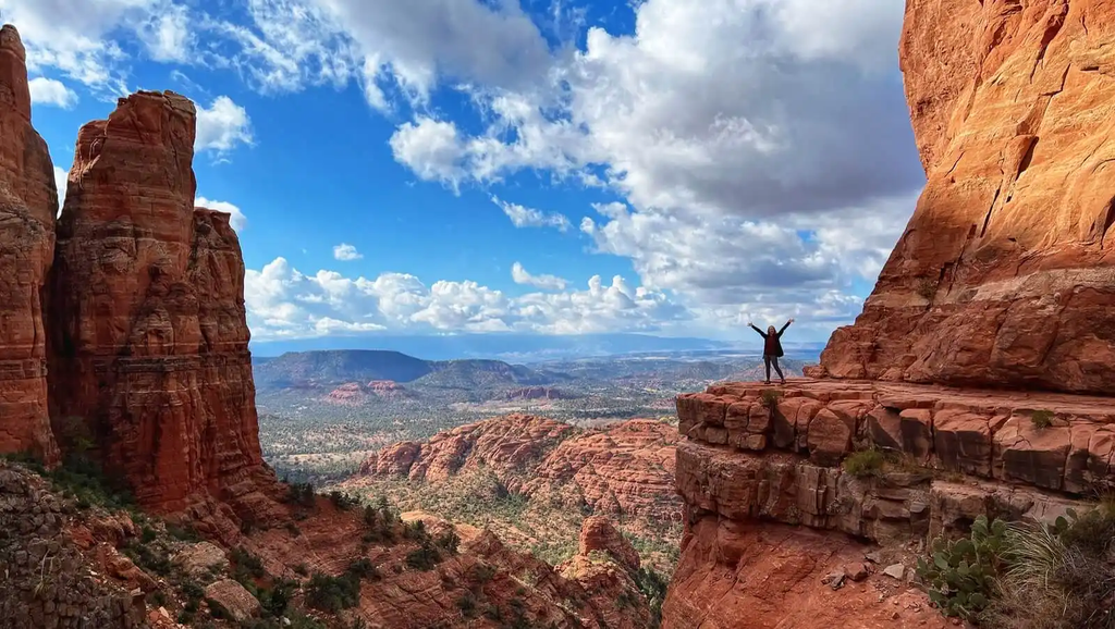
If you want the classic Cathedral Rock photograph without the strenuous trail, drive to Red Rock Crossing at the Crescent Moon Picnic Site instead.
This spot, reached via Upper and Lower Red Rock Loop Road off SR 89A in West Sedona, gives you Cathedral Rock reflected in Oak Creek, the image on most Sedona postcards.
- A day-use fee applies at Crescent Moon, and a Red Rock Pass is not accepted, so bring cash or a card.
- Red Rock Loop Road itself is about 8 to 10 miles and passes Red Rock State Park, worth combining into one outing.
Sedona Self-Driving Tour Cost: Passes, Apps and What’s Actually Free
One of the more common questions we get is what a Sedona self-driving tour cost actually looks like once you add everything up. Here is a realistic breakdown.
| Item | Approximate Cost | Notes |
| Red Rock Pass (day) | $5 | Required at most Coconino National Forest trailheads and pull-offs |
| Red Rock Pass (week) | $15 | Best value for multi-day self-guided trips |
| Red Rock Pass (annual) | $20 | Worth it if you visit Sedona more than twice a year |
| Chapel of the Holy Cross | Free | No pass or ticket needed |
| Airport Mesa Overlook | $3 / vehicle | $3 daily fee at the upper Vista lot; lower Saddle lot is free (Red Rock Pass not required) |
| Slide Rock State Park | Approx. $10 to $30/vehicle | Separate from Red Rock Pass, priced by state parks |
| Red Rock Crossing / Crescent Moon | Separate day-use fee | Red Rock Pass not valid here |
| Shaka Guide audio app | Approx. $16 | One purchase covers the whole vehicle |
| GuideAlong audio app | Approx. $17 | Offline GPS-triggered narration |
| Gas for a full-day loop | Varies | Roughly 40 to 60 miles total driving |
A Red Rock Pass is not required for stops of about 15 minutes or less, but it applies anywhere you park for a hike or extended stop on national forest land.
The pass does not work everywhere: it is not valid at West Fork, Crescent Moon, Grasshopper Point, Beaver Creek or Lower Lake Mary, and Slide Rock is a state park with its own separate fee.
Compared to guided van tours running $80 to $150 per person, a standard self-guided day visiting Bell Rock ($5 Red Rock Pass), Airport Mesa ($3 fee), Chapel of the Holy Cross (free), and Crescent Moon ($12 day-use) costs $20 in total passes and fees for the whole vehicle (or up to $50 if substituting Slide Rock State Park at peak season rates), making it far more economical for families.
Best Sedona Self-Driving Tour By Timeline: Half Day, Full Day or Two Days
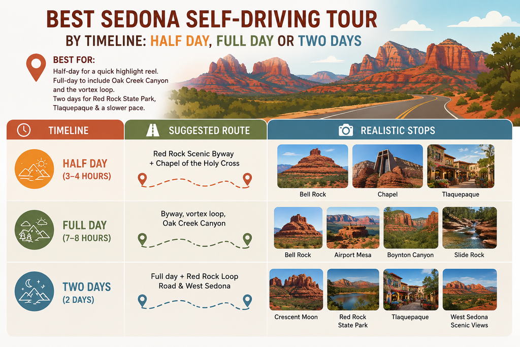
Best For: A half-day loop suits visitors staying one night who want the highlight reel. A full-day itinerary suits anyone wanting Oak Creek Canyon and the vortex loop in the same trip.
Two days work best if you also want Red Rock State Park, Tlaquepaque, and a slower pace through West Sedona.
| Timeline | Suggested Route | Realistic Stops |
| Half day (3 to 4 hours) | Red Rock Scenic Byway plus Chapel of the Holy Cross | Bell Rock, Chapel, Tlaquepaque |
| Full day (7 to 8 hours) | Byway, vortex loop, Oak Creek Canyon | Bell Rock, Airport Mesa, Boynton Canyon, Slide Rock |
| Two days | Full day plus Red Rock Loop Road and West Sedona | Adds Crescent Moon, Red Rock State Park, extra Uptown time |
Still figuring out your itinerary? Read our guide on How Many Days in Sedona to help you decide how much time you need.
Worth the extra drive? Oak Creek Canyon is the one stretch we consistently hear guests say they almost skipped and were glad they did not.
It is a 30 to 40 minute detour round trip from the main loop, and it looks nothing like the rest of Sedona.
Current Road and Trail Closures Affecting Your Sedona Driving Tour
This is the part most driving tour guides skip, and it matters this season.
Following the Pocket Fire, which burned more than 27,000 acres, the U.S. Forest Service issued a closure order running July 31, 2026 through September 30, 2026, plus a 100-foot buffer on either side of the West Fork drainage.
- Closed trails: Bear Sign, David Miller, Dry Creek, HS Canyon, Secret Canyon, West Fork.
- Closed recreation sites: Banjo Bill, Bootlegger, Call of the Canyon, Encinoso, Grasshopper Point.
None of this affects driving SR 89A through Oak Creek Canyon itself, since the highway remains open and Sedona is operating normally.
It does mean skipping West Fork and Grasshopper Point from your stop list until the order lifts, so check fs.usda.gov’s Coconino National Forest pages before your trip.
Shuttle Routes and Parking Lot Closures To Plan Around
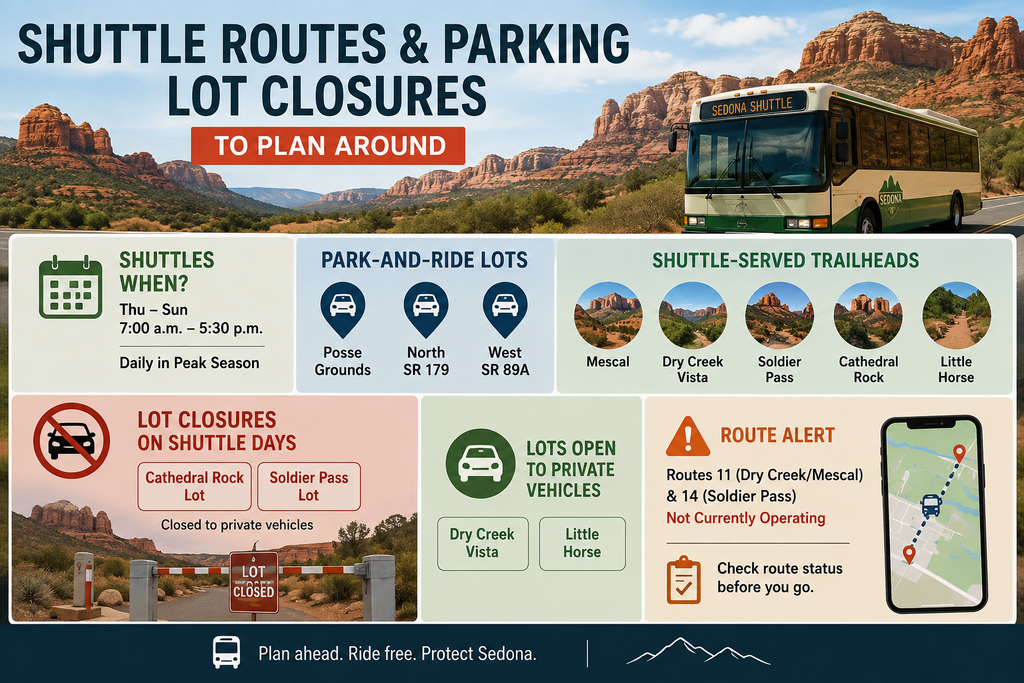
Sedona operates a free shuttle system on certain days to ease trailhead congestion, and it directly affects where you can park.
- Shuttles run Thursday through Sunday, 7:00 a.m. to 5:30 p.m., and daily in peak season, from park-and-ride lots at Posse Grounds, North SR 179 and West SR 89A.
- Shuttle-served trailheads include Mescal, Dry Creek Vista, Soldier Pass, Cathedral Rock and Little Horse.
- On shuttle days, the Cathedral Rock and Soldier Pass lots close to private vehicles, while Dry Creek and Little Horse stay open.
- Routes 11 (Dry Creek/Mescal) and 14 (Soldier Pass) are not currently operating, so confirm route status before relying on them.
If your itinerary includes Cathedral Rock on a Thursday through Sunday, view it from Red Rock Crossing instead, since that trailhead lot will likely be closed during shuttle hours.
Drivers curious about Soldier Pass Road should also note its access gate is always closed from 6 p.m. to 8 a.m.
Where To Stay For A Sedona Self-Driving Tour: Stay Wandery’s Five Sedona Properties
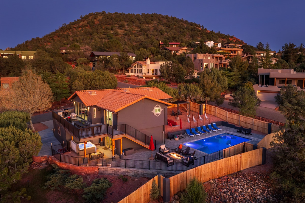
Every stop on this route is easier to reach when your home base sits close to both SR 179 and SR 89A, which is how our five Stay Wandery properties are positioned.
| Property | Sleeps | Key Features | From/Night |
| Uptown EPIC! | 25 | 2 pools & spas, 2 kitchens, game rooms, fire pits | ~$2,242 |
| Uptown Sparks! | 13 | Heated pool & hot tub, red rock views, fenced yard | ~$460 |
| Starview Sedona! | 12 | Heated pool, hot tub, arcade, pool & ping pong | ~$560 |
| SkyLine Sedona! | 12 | King beds, red rock views, fire pits, arcade | ~$598 |
| Uptown Splash! | 12 | Heated pool, hot tub, swim spa, putting green | ~$460 |
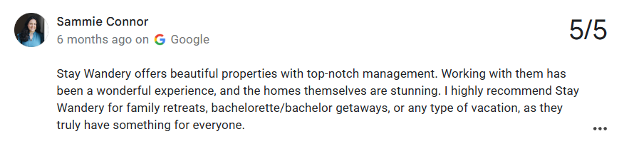
Holding a 4.4-star rating on Google, each of our five locations sits right near the byway and vortex loop to ensure seamless travel. Since seasonal demand impacts nightly pricing, verify our current rates directly prior to booking.
Your Self-Guided Sedona Adventure Starts Now
A Sedona self-driving tour comes down to three separate drives done well rather than one giant loop done in a rush: the Red Rock Scenic Byway south of town, Oak Creek Canyon to the north, and the West Sedona vortex loop toward Boynton Canyon.
Checking guests in every week, we notice the trips that go smoothest are the ones where people picked two or three routes and gave each real time, rather than cramming everything into one afternoon.
Check current trail and road closures before you go, since this season’s wildfire recovery work has taken a few stops off the table temporarily.
Bring a printed or downloaded map as backup, since signal drops in parts of the canyon.
If you are still deciding where to stay, our five Stay Wandery properties sit close to both main highways, so you are never far from the next stop.
We are happy to share current conditions or parking tips at check-in, since we drive these roads constantly ourselves.
FAQs | Self-Guided Sedona Driving Tour
1. Can you tour Sedona on your own without hiring a guide?
Yes, and most visitors do exactly this. Sedona’s main attractions sit along two paved highways with clear signage, and neither requires four-wheel drive or off-road experience to reach the stops covered in this guide. The only real skill involved is planning your stops in advance, since a few trailhead lots fill early on weekends. Guided tours add value through narration, history, and route optimization, not through access you could not get on your own. Many of our guests arrive planning to book a van tour and end up driving themselves after realizing how straightforward the roads are. If you want the storytelling without the group schedule, a paid audio tour app splits the difference nicely.
2. Is there a truly free Sedona driving tour map available?
Yes. Official maps are available directly from Coconino National Forest visitor centers (including the South Gateway Visitor Center on SR 179) and Visit Sedona (visitsedona.com). You can additionally build your own custom route in Google Maps using the addresses and stops listed throughout this guide, which is what most of our guests end up doing. Paid apps like Shaka Guide and GuideAlong add narrated stories and offline GPS on top of the route, but they are not required to navigate.
3. How much does a Sedona self driving tour cost compared to a guided van tour?
A self-guided day typically runs $20 to $50 per vehicle in passes and entry fees depending on your specific stops (for example, $20 total for Bell Rock, Chapel of the Holy Cross, Airport Mesa, and Crescent Moon, or up to $50 if including Slide Rock State Park during peak summer pricing), plus gas for 40 to 60 miles. Guided van tours commonly run $80 to $150 per person, so a family of four can save several hundred dollars by driving themselves. The trade-off is commentary.
4. Do I need a Red Rock Pass for every stop on a self-guided tour?
No. Stops of about 15 minutes or less, like a quick photo pull-off, do not require a pass at all. Longer stops at national forest trailheads and picnic areas do require one, purchased as a $5 day pass, $15 week pass, or $20 annual pass. Several popular spots use their own separate fee system instead, including Slide Rock State Park, Crescent Moon Picnic Site, Grasshopper Point, Beaver Creek and West Fork, so a Red Rock Pass will not get you into those.
5. Can you do the self-guided vortex tour Sedona is known for without hiking?
Mostly, yes. Airport Mesa and Bell Rock both offer a short walk from the parking lot to a viewpoint, with no serious hiking required to reach either one. Boynton Canyon’s road in passes scenic canyon walls even if you skip the full 6-mile trail. Cathedral Rock is the exception, since its actual summit trail is a steep, strenuous scramble. Most self-driving visitors view Cathedral Rock instead from Red Rock Crossing at the Crescent Moon Picnic Site, which requires only a short, flat walk from the parking area.
6. What’s the best time of day for the Airport Mesa sunset drive?
Arrive at least 45 minutes before sunset to secure a spot in the small lot, since it is the tightest parking situation of any stop on this route. Weeknights are noticeably calmer than weekends, when the overlook can feel crowded well before the sun actually sets. If the lot is full, limited roadside parking exists along Airport Road, though enforcement has tightened recently. Several Stay Wandery properties also offer red rock views directly from the property, so guests sometimes watch sunset at home first, then drive up later once the crowd thins.
7. Is the Oak Creek Canyon drive worth doing if I only have one day in Sedona?
Most guests who almost skip it tell us afterward it was their favorite part of the trip. It adds about 30 to 40 minutes round trip from the main loop, and it looks distinctly different from the red rock desert scenery south of town, with forested canyon walls, switchbacks and creekside pull-offs. Keep in mind that some picnic areas within the canyon are closed this season for wildfire recovery, covered in detail earlier in this guide, so check current status before planning a stop there specifically.
8. Are there any road closures affecting a Sedona self-driving tour right now?
As of August 2026, several trails and picnic areas in Oak Creek Canyon are closed through September 30, 2026, following the Pocket Fire, including West Fork Trail, Grasshopper Point, and Bootlegger. The Oak Creek swim area is also closed until October 1, 2026. SR 89A and SR 179, the two highways that carry nearly all of this driving tour, remain fully open, and Sedona itself is operating normally for driving, dining and sightseeing.
9. Do I need to book anything in advance for a self-guided Sedona itinerary?
Generally no, though summer weekends at Slide Rock State Park can mean waiting at the gate once the parking lot fills, sometimes for an hour or more. Booking your accommodation in advance matters far more than booking any single attraction, since Sedona lodging sells out during peak spring and fall weekends. If your dates are flexible, a Tuesday or Wednesday visit avoids both the shuttle closures on Cathedral Rock’s lot and the heaviest weekend byway traffic.
10. What’s the best scenic drive in Sedona if I only have time for one?
The Red Rock Scenic Byway along SR 179 packs the most iconic views into the shortest drive, at about 7.5 miles connecting Interstate 17 to Uptown Sedona. If you have time for a second drive, Oak Creek Canyon offers the sharpest contrast, since it feels like a completely different landscape only minutes away. Guests short on time often combine the byway with a quick stop at Chapel of the Holy Cross, since the two sit just off the same road.
Sources Consulted:
- Coconino National Forest, U.S. Forest Service (fs.usda.gov), trail data and closure orders
- Arizona State Parks (azstateparks.com), Slide Rock State Park fees and hours
- Sedona.net official driving tour route
- Chapel of the Holy Cross visitor information
- Shaka Guide, GuideAlong and Action Tour Guide, audio tour pricing
- NOAA National Centers for Environmental Information, 1991 to 2020 climate normals, station USC00027708
- Our team’s operational experience hosting guests at Stay Wandery, Sedona